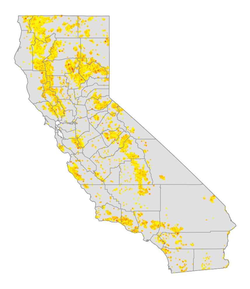
Outline
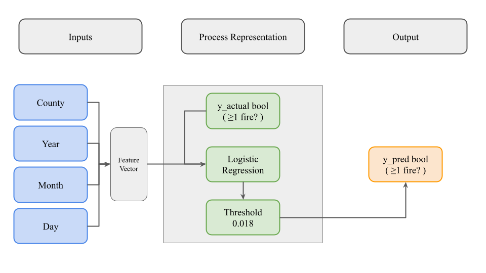
Here, our model is trying to predict a binary output (True/False) whether or not at least one fire will occur on a given county and date.
Our model takes two inputs. The first is an integer that represents a county. The second is a date that is split into 3 distinct features (year, month, day).
These four features are combined into a feature vector. We have a list of y values that are either True or False. Our y values represent whether a county on a given date actually had one or more fires that day.
We used logistic regression with the Python module statsmodel, to get a decimal value.
We evaluated this decimal value to be above or below a threshold we set while we were tuning hyperparameters, which is 0.018.
Above means True, below means False. We then compared those predicted y values to the actual y values to evaluate our accuracy.
1. Combining JSON Files
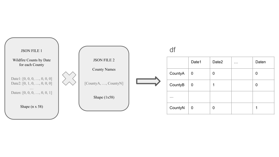
First, we combined two json files. The first json file had a list of vectors of 0s and 1s.
Each vector had a length of 58, representing the amount of counties. The order is important. Each 0 represents a fire was not present in that county, and 1 represents a fire was present.
The number of vectors represent how many unique dates was recorded by the MODIS satellite in our 10 year dataset.
The second json file was a simple list of all 58 County names, in order according to the other json file. The previous dataset was not named.
We combined these two json files to create a dataframe, which allowed us to see the binary fires with the County names.
2. Extracting Date Features
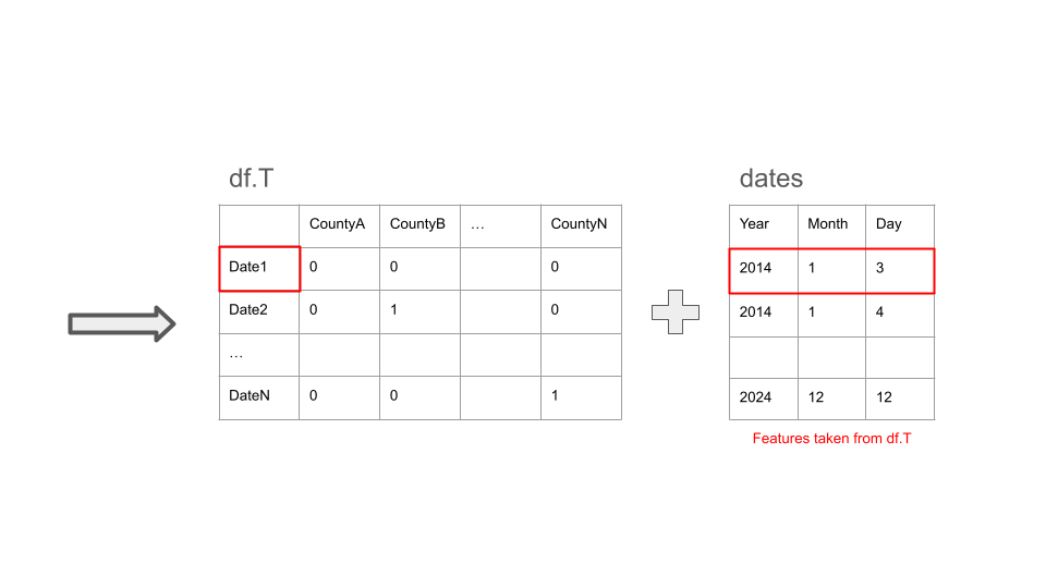
Next, we transposed the dataframe to make it easier to process later on.
We took the date column, and extracted the year, month, and date from each element. This is to make more features for the model to train with.
We combined those features into the transposed dataframe.
3. Building Feature Dataframe
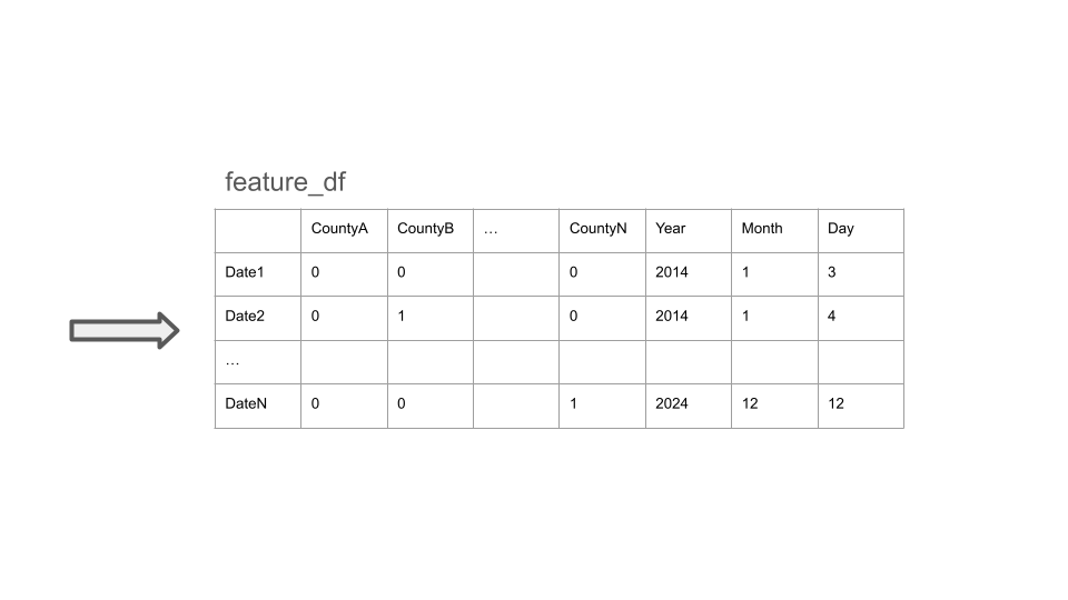
Let us now call this combined dataframe as feature_df.
4. Extracting y Vector
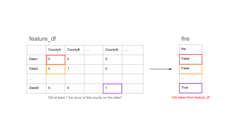
Meanwhile, we took feature_df, and created a new vector of booleans. This is to get our actual y values, since we are predicting whether a fire has occured at a County on a specific date.
We iterated through the feature_df in this order: (Date1, CountyA), (Date2, CountyA), ..., (Date1, CountyB), ..., (Date_n-1, CountyN), (Date_n, CountyN).
Our new vector has a length of the number of dates times the number of Counties.
5. Combining y Vector
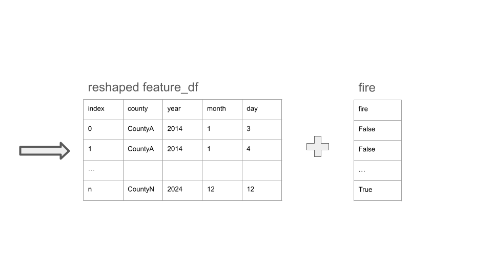
In order to incorporate our new y value vector, we had to reshape the dataframe to match the length.
Instead of having 58 columns as counties, we condensed it into a single column within feature_df, assigned integers representing each county,
and numbered them on that new column.
This allowed us to combine the reshaped feature_df and y value vector easily.
6. Train/Test Split
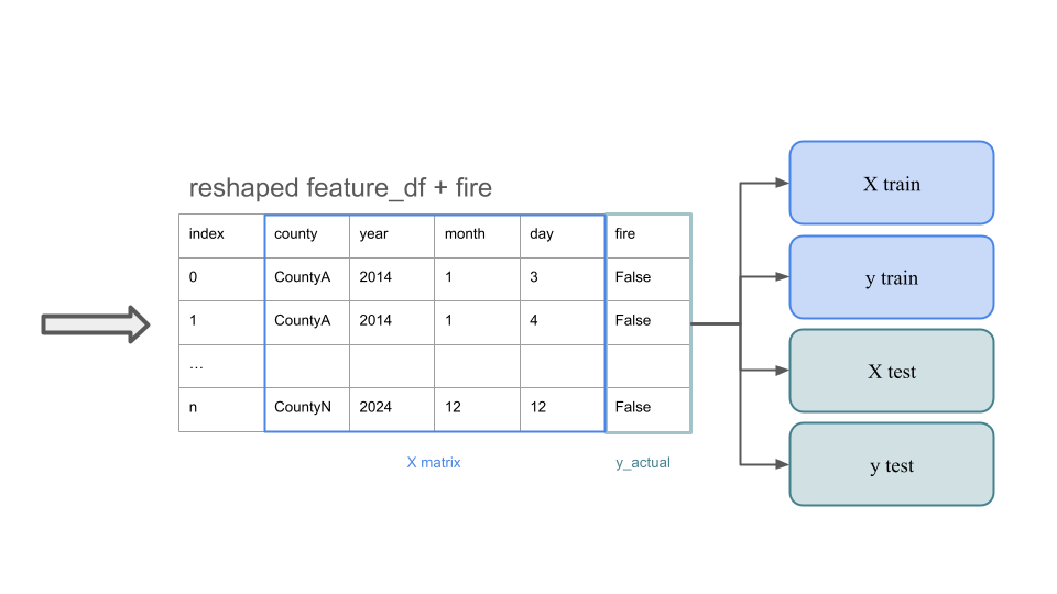
Now, we finally have our X matrix and y vector.
We split this into a train/test split, and prepared to train the model.
7. Fitting Model
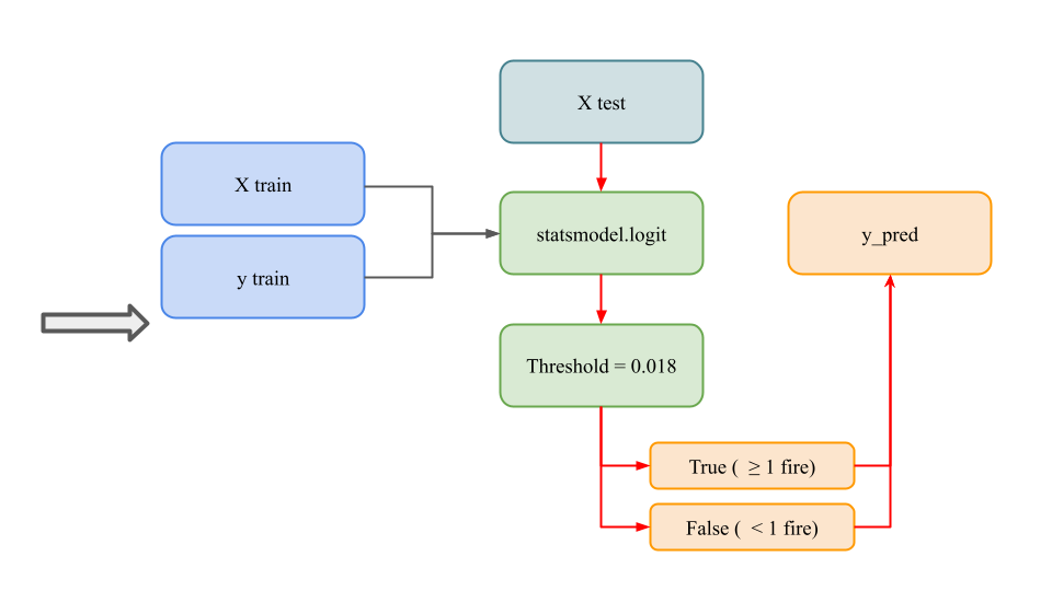
We used X train and y train to fit our logistic regression model.
Then we passed X_test through our model, and processed the decimal outputs through a threshold of 0.018.
This allowed us to make our y predicted outputs as booleans.
8. Evaluating Predictions

Finally, we compared our actual y values to our predicted y values.
We evaluated our accuracy based on the amount of True Positives and True Negatives over the total number of predictions.
Ultimately however, we did sacrifice some accuracy to get less False Negatives,
because we would rather not be preparred for a fire that never broke out, versus being unpreparred for a fire that is about to break.
❮
❯